Communicating geospatially varying risk of storm surge to diverse audiences
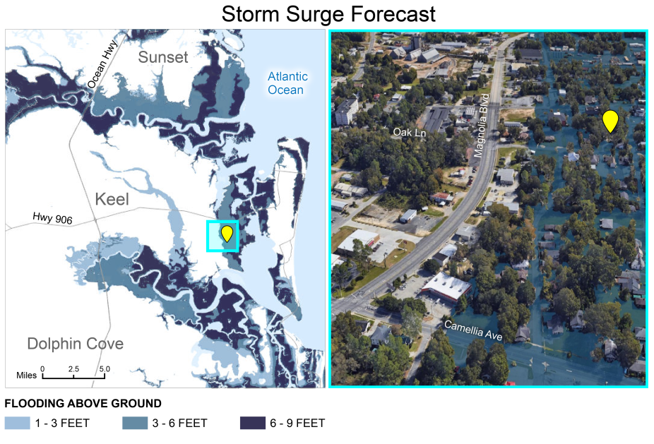
Weather forecasters and emergency managers often use geovisualizations to communicate hurricane storm surge risks and threats to the public. New study published in Weather, Climate and Society explores the effectiveness of geovisualizations in hurricane storm surge risk communication through a large population survey. The survey results show that while the geovisualizations of storm surge risk can be effective generally, they were less effective in several important and vulnerable groups. Researchers found substantial impacts of race, income, map-reading ability, place attachment, and scale of place on how people connected the storm surge risk shown in the visual to a place. These findings have implications for future research and for considering the way weather forecasters and emergency managers communicate storm surge information with diverse audiences using geovisualizations.